
The liquid fraction is a key component in the movement of sediment on a steeply sloping mountain side (>15%) and can give rise to debris flows. Most of debris flows are triggered by rainfall events characterised by heavy precipitation as in showers and thunderstorms. In particular, it is the intensity of precipitation over a period of time, or rainfall rate, that is decisive in causing favourable conditions for the triggering of a debris flow: with high rainfall intensity significant amounts of water can be recorded even in a short time, which in turn can trigger an intense surface runoff, capable of moving the sediment.
Convective phenomena such as showers or thunderstorms increase therefore the possibility of a debris flow event. The time of the year when this type of precipitation is most frequent varies both with latitude and altitude. In the Alpine areas, this period lasts on average from May to September, while heavy rain showers and thunderstorms are rarely observed in the winter season.
However, in recent decades convective events have been recorded with a certain frequency even outside the summer months, when the actual risk of debris flow is usually considered small.Rain showers and thunderstorms are characterised by rapid and significant changes in rainfall intensity, both in space and time. They are usually localised and short-lived, but under certain weather conditions they can frequently regenerate and intensify over the same areas, leading to persistent rainfall. Thunderstorms are additionally characterised by the presence of an imposing vertical cloud, called a cumulonimbus, lightning and thunder, heavy rain, wind gusts, possibly hail and even tornadoes.
The extent of thunderstorms varies according to the physical characteristics of the convective system. There are unorganized thunderstorms or single cell thunderstorms (e.g. heat thunderstorm), which are isolated, act on a small portion of the territory and are favoured by local conditions and orography. Additionally there are organized thunderstorms or multi-cell thunderstorms, such as clusters, squall lines, self-regenerating systems, MCS (Mesoscale Convective System), MCC (Mesoscale Convective Complex), etc. Their spatial extension can reach hundreds of kilometres and they are associated with large scale weather forcing like as frontal systems. The life cycle of a thunderstorm phenomenon is also related to the physical characteristics of the system: the average duration of unorganised thunderstorms is limited in time and ranges from 15 to 30 minutes, with a maximum limit of 1 hour, while organised thunderstorms can have a duration that varies from 1 hour to 2 to 3 hours and the precipitation thus gets a more persistent character.
Every single storm, organized or unorganized, can potentially lead to critical situations in an area, depending on the spatial extension, and becomes more or less serious depending on the rainfall intensity and its duration. In particular it is the intensity of rainfall over time that is the absolute parameter determining a more or less serious critical situation. It is therefore necessary to distinguish thunderstorms not only for their spatial extension, but also for their most important characteristic: generating rainfall between moderate and heavy, heavy, very heavy intensity or even with a stormy nature. Therefore, a distinction is made between thunderstorms and severe thunderstorms. The latter are convective phenomena characterized by high precipitation rate (rainrate > 30-40mm/h), allowing large quantities of water to accumulate within a short period of time. Thus, not only conditions for triggering a debris flow, but also the probability of a flow of high magnitude are more favorable.

Therefore the total amount of rainfall is less important than the rainfall rate over a catchment area, that is how quickly the rainfall accumulates. The hourly rate of rainfall gives a measure of the intensity of precipitation and, in the connex of debris flow even more so, the precipitation rates at shorter time scales, e.g. in 5 or 10 or 30 minutes. For this reason pluviometric thresholds are defined, indicating a minimum value of rainfall over several different time intervals at which it is highly probable that a debris flow will occur. These thresholds are determined by statistical methods applied on data originating from past events in the area under examination. Rainfall thresholds are characteristic of each basin, due to the different geological, morphological and hydrological conditions characterising each of the sites. Rainfall in general and thus convective phenomena are favored by the orography, strongly interacting with the atmospheric circulation. Mountain spurs generally form a barrier to the flow of dominant currents that impact on them. Clouds and precipitation are generated on the windward slopes, in particular when humid and unstable air mass (for example in the presence of a cyclonic circulation) hits the mountains. This process is even more pronounced where the humid and unstable flow impacts perpendicularly on a mountain slope (flow-orography interaction).
Furthermore, a mountainous context can favor the additional lift of warm and humid air, already rising due to the initial heating from the ground. In fact, during sunny days of late spring and summer, undisturbed solar radiation in the morning and early afternoon strongly heats the ground. The heat, that in turn is released from the ground, raises the temperature of the lowest layer of air right above the ground. As the temperature in the lowest layer of air above certain surfaces increases, the density of this air parcel decreases and it becomes lighter than the air above other, colder surfaces in the surroundings. If the comparatively colder air pushes under the warmer air, the warmer air parcels detach from the surface and start to rise. As a result, a series of rising air bubbles creates thermals that can be incorporated into an existing air flow and forced to even stronger vertical motion by interacting with the orography of the mountains.

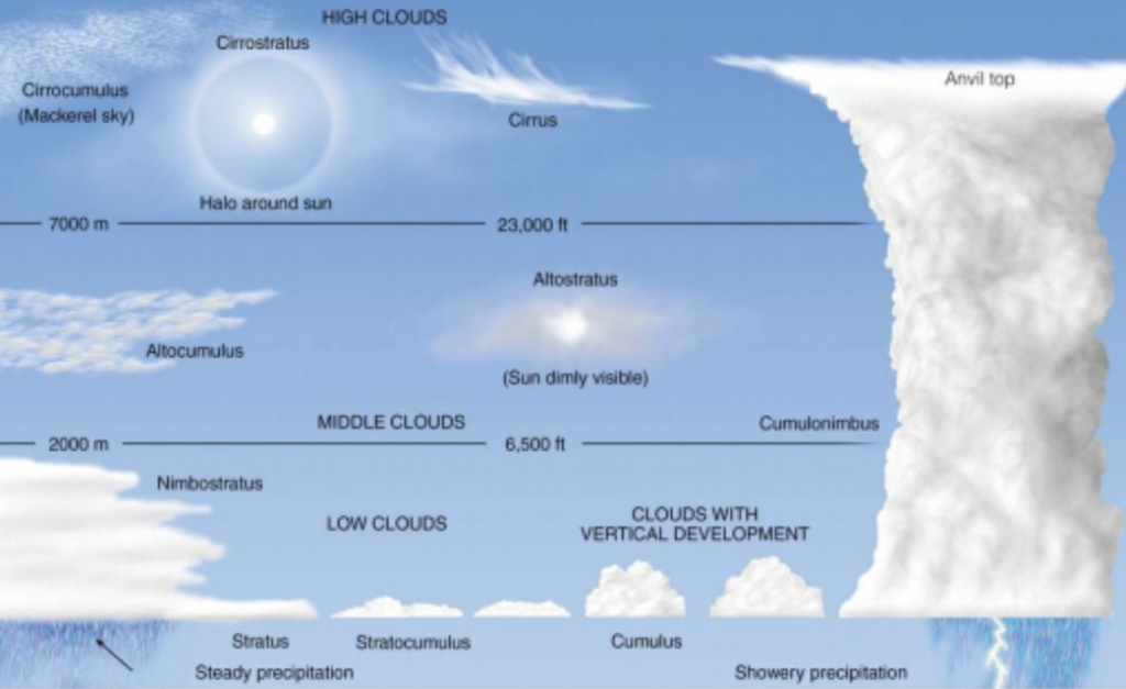
The vertical motion of the air parcels continues as long as the rising air is warmer (and thus lighter) than the ambient air at the same altitude. The formation of thermals is further enhanced along mountain slopes when the sun heats the rocky slopes and causes more warm air bubbles to detach on site. These can combine to form large thermal tubes and cause a constant current of rising air. As the air parcels rise in a thermal tube, the air pressure in the air parcels drops, they expand and thus cool down. Below a certain temperature, which depends on the moisture content of the air parcel, the water vapor carried inside the air parcel condenses and the first cumulus clouds form. Under certain meteorological conditions (e.g. the presence of cold air at high altitude, whereby the rising air parcels always remain lighter than the surrounding air), these cumulus clouds can grow into cumulonimbus clouds and form thunderstorm structures.
Thunderstorms, as well as intense rain showers that do not develop electrical activity, are unpredictable in terms of their exact intensity, location and timing. In meteorological forecasting activities it is only possible to assess the presence of favourable physical conditions for the development of thunderstorms. It is, however, not possible to predict exactly where and when thunderstorm cells will form as well as the associated phenomena, such as rain, hail, lightning and wind gusts. Especially when forecasting strong thunderstorms, it is therefore more useful to forecast the probability of the occurrence of the phenomenon over a specific geographical area. This specifically includes the occurrence of heat thunderstorms, which are usually triggered in the mountains on hot summer days (but are also not excluded in the lowlands) and can cause extremely heavy precipitation (up to > 1mm/minute) for just a few minutes. Although these thunderstorms are extremely limited in space and disorganized, they are still dangerous due to the extreme intensity of the precipitation and the associated hydrogeological risk. It is therefore necessary to remember what was written earlier: Any single thunderstorm, whether organized or unorganized, can lead to critical situations that are more or less extensive depending on the spatial extent and more or less severe depending on the intensity of the precipitation and its duration.Debris flows can also occur following abundant stratiform or mixed stratiform/convective rainfall distributed over a period of up to 48 hours or more and characterised by precipitation pauses but also by different phases in precipitation intensity. Especially during the early autumn season, the most abundant precipitation events usually occur on the South side of the Alps, in association with the bad weather situation caused by broad and structured low-pressure systems that can influence the atmospheric circulation on spatial scales of thousands of kilometers (synoptic scale). These areas of low pressure have a center of action – e.g., a surface pressure minimum – to which the warm and cold fronts relate. Stratiform precipitation occurs during the passage of the warm front and the entire warm sector. However, convective precipitation in the form of showers due to cumulus clouds can be embedded in the cloud cover of the warm front (nimbostratus). The cumulative precipitation amount may already be abundant due to the continuity and duration of the stratiform precipitation, rather than due to the mostly weak to moderate, rarely strong, precipitation intensity. In such a precipitation regime, the soil is gradually saturated with water. As a consequence, the top layer of soil becomes more impermeable to further precipitation and favors surface runoff. This can subsequently begin to move sediment downstream following the steep slopes of the canyons. During the subsequent cold front passage associated cumulus and cumulonimbus clouds possibly generate intensive convective precipitation of short duration. This additional short-term heavy precipitation can lead to a subsequent triggering of a debris flow of greater magnitude, as the intensity of the precipitation is on average much higher than that of the first phase.