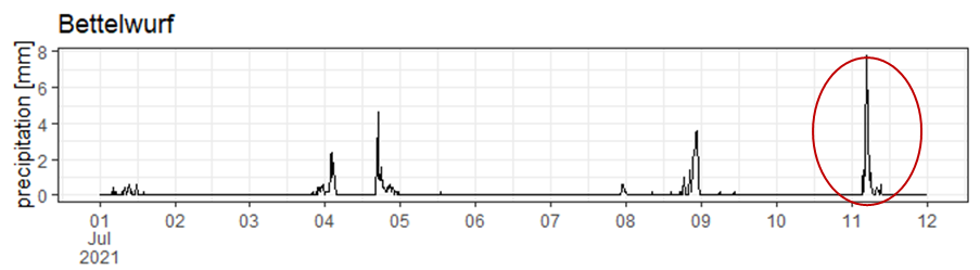
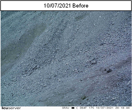
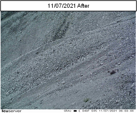
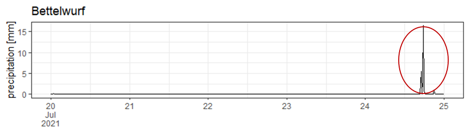
The month of July started with a series of rainfall events in North Tyrol (Figure 1). The heavy rain in the night from July 10 to 11 triggered sediment mobilisation in the Bettelwurf catchment. The event occurred between 4:45 and 5:00 AM, just after the highest intensity of the rainfall event, with ca. 8 mm within 15 min (red circle).
Subsequent slides of the steeped slopes were detected two weeks later, with the next rainfall event taking place between 5:00 – 6:00 PM on July 24 (Figure 3).
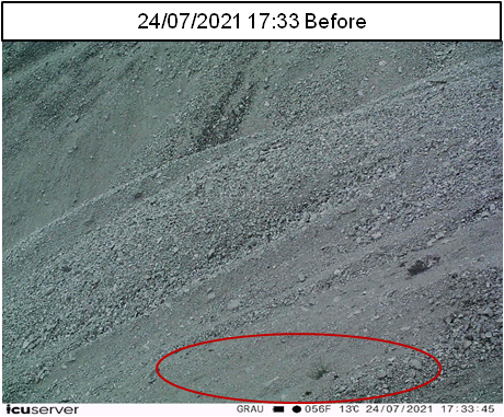
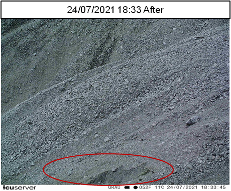
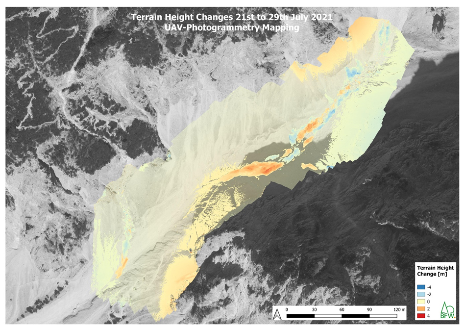
To detect areas with sediment mobilisation between the two rainfall events, a UAV flight was carried out after each event on 21th and 29th July 2021, respectively. Figure 3 shows terrain height changes caused by the rainfall on 24th July; erosion zones are highlighted in blue, and areas with sediment deposition in orange-red. On both campaigns, the aerial imagery was collected with a DJI Mavic 2 Pro UAV with a 20MP Hasselblad camera flown 80m above ground level with 85% front- and 80% side-overlap. Georeferencing was provided by 15 ground-targets distributed in the flight area and terrestrially surveyed with an Emlid Reach RS2 dGNSS. Photogrammetric processing was performed in Agisoft Metashape Pro and the resulting 3D point clouds were used to calculate terrain height changes in the Cloud Compare routine M3C2.