Partners of the INADEF project gathered on the 9th of December to discuss the modelling chain underlying the new Early Warning System.
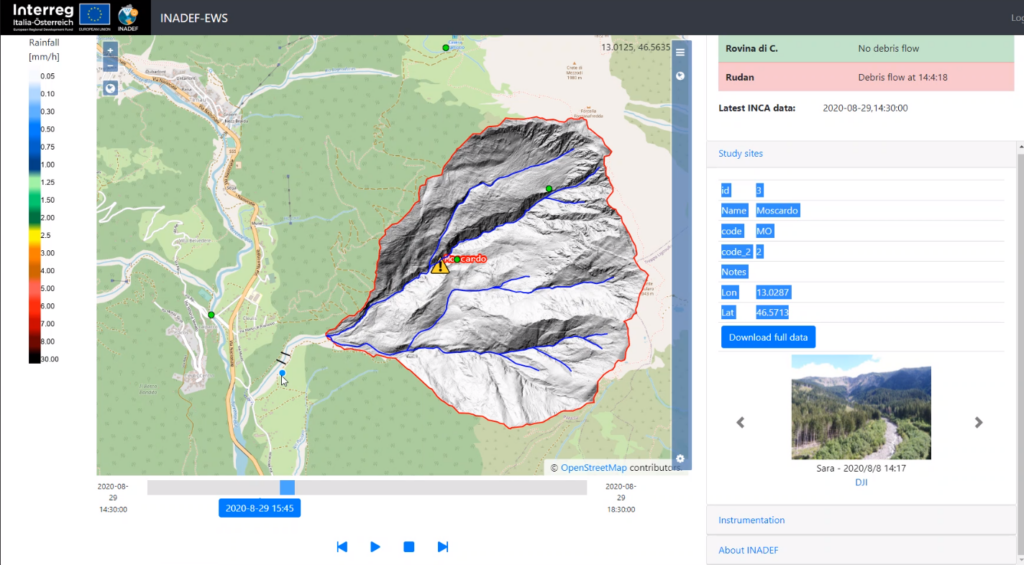
A prototype of the model has been used to simulate 68 past debris flow events, occurring in recent years in the locations of the selected case studies ( Rio Rudan and Rovina di Cancia in Veneto, Rio Moscardo in Friuli-Venezia Giulia, Bettelwurf and Gröbentalbach in Austria ). Several algorithms were taken into account to report the distribution and intensity of rain events. Data recorded by local monitoring stations, partially upgraded thanks to the INADEF project, have been fundamental for the calibration of the model parameters.
Allerts generated by the INCA model have been analyzed and compared to real debris flow events, in order to evaluate all possible false-allarms generated by the system.
Furthermore, a prototype of the Web-GIS page was presented to partners. Once made accessible to public, it will let users visualize the current weather condition and its forecast, and identify any potential local allert for debris flow events determined by the INADEF model within the 5 case study areas.